Disclaimer:
**This is a not too exciting story that I am recounting for my own personal benefit more than for anyone’s entertainment. It was a struggle, a lesson in backpacking and now I have three full pages written**
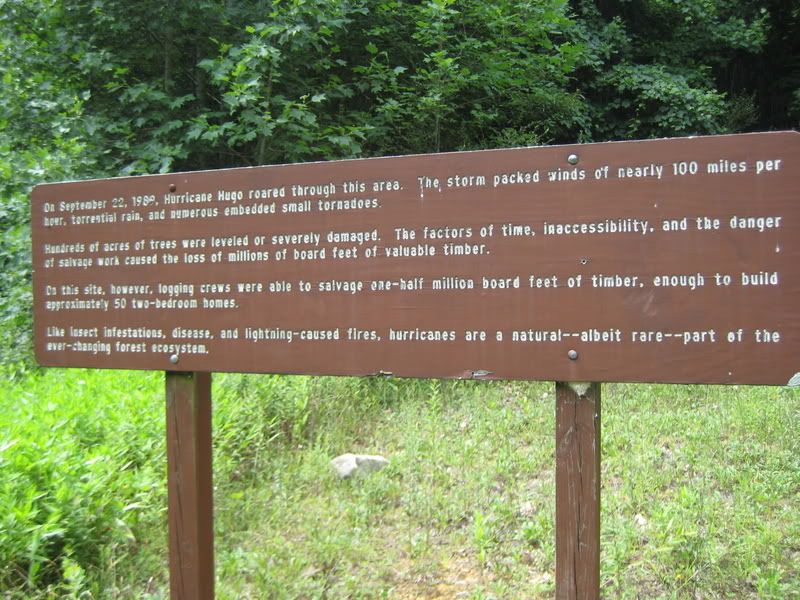
For my second and third days of vacation, I had decided to do an aggressive two day hike through Jones Gap and Caesar Head State Parks. I packed my pack pretty heavy as I wanted this hike to be another one of those “training days” for the pain and suffering coming up in the Fall. I had even thought about lugging a full bottle of wine around with me for the haul but declined at the last minute for a flask of Bullets Bourbon.
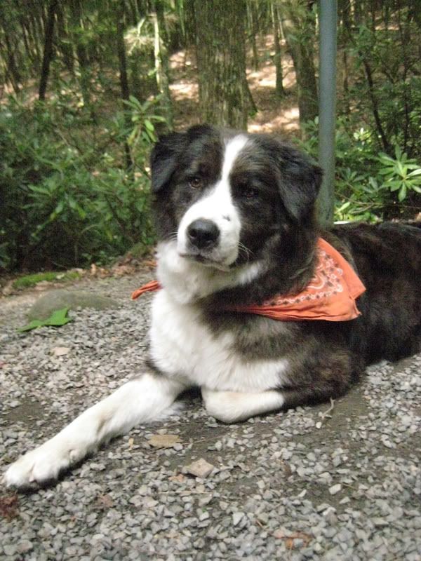
My partner for the trip was Buddy as the temps would again be pushing 100+ with a humidity that was unsurpassable. It seems lately, that no matter what I do, I reek of my own stupidity. Here I was dehydrated from the day before but for some unholy reason I thought I could make it the 12 miles to Caesars’ Head with only four liters of water.
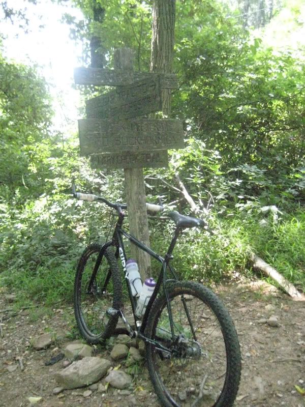
I wanted an early start but I hadn’t registered my overnight stay so I knew I needed to talk with the rangers before taking off. When I arrived ~9:45am on Tuesday morning I realized I had made another mistake. The Jones Gap office didn’t open up until 11:00 so I used my cell to call the Caesars’ office and was able to make a reservation over the phone. She told me that there was no camping on my route but that if I made a “slight” detour on “Natural Land Trust Trail” I would find my campsite D1. We were off.
My planned route for the day was to hike the entire 10 miles of Pinnacle Pass trail to Natural Land Trust where I would shore up for the evening and then go on the search for water.
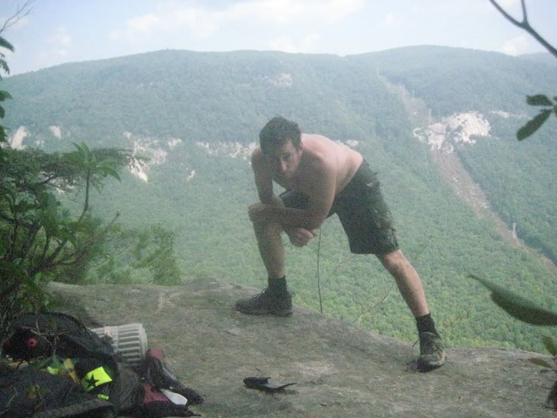
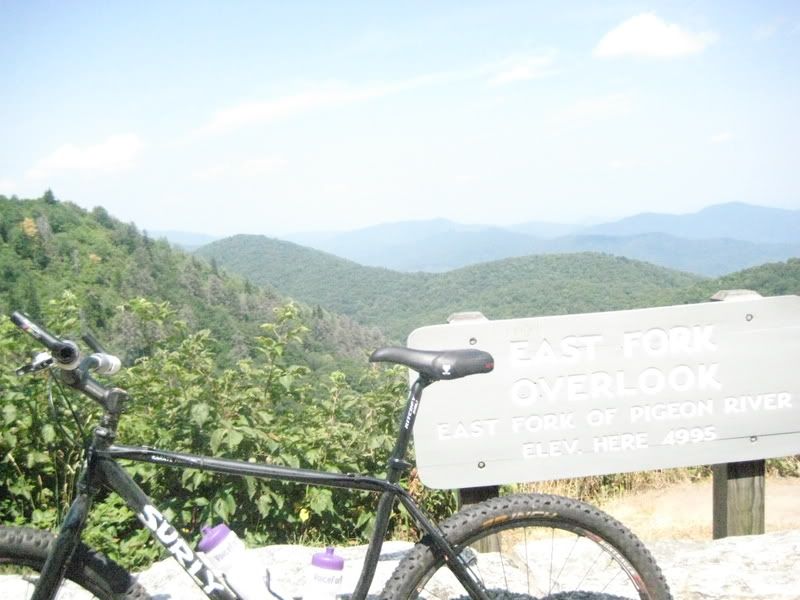
With the first mile and a quarter of Pinnacle Pass behind me I was already at the stunning overlook and we took our time to take the view in. I was already dripping head to toe with sweat from the heat and humidity. My shorts were so soaked that as I sat there taking in the view, there were little streams of sweat water running off the rocks. Hiking in cotton shorts is bad and I knew that but being a moron, I did it anyway.
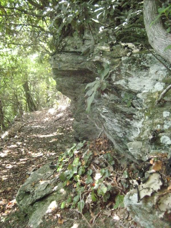
The next four miles on the Pinnacle Pass trail had some highlights as one rock outcropping reminded me of the slick rock 360 that is in Dupont at the top of Big Rock and Cedar Mountain. However, those first five and a quarter miles on the Pinnacle Pass trail were the hardest I have ever encountered. Besides a small flat section for a mile in the middle, the trail was either going straight up or down. With a 35 – 40 lb pack on it made for some tough going and I had drank all of my four liters of water in these first five miles. I thought I had iodine tablets in my first aid but I was wrong. Can you see a recurring theme here?
I knew that at the five mile mark I could hike a mile back down Oil Camp Creek Road and fetch/steal water from a house so I took that route. I took Buddy with me as an accomplice and found two vacation homes. The first had the water turned off and I wanted to cry, however at the second house there was a hose with cold water, OH THE BLISS. I drank one full bottle and then filled up with four more. That would make five liters drank with four more in the pack. I figured I was fine until I crossed paths with the Caesars’ visitor center.
A thunderstorm reared its ugly head and after leashing Buddy to make sure he wasn’t spooked by the storm we took off for the five miles of Pinnacle Pass that I had never been on with seven miles of hiking behind us. The walk to 276 was wonderful as the rain continued the entire way up, I was finally cooling off even though I knew my shorts were chaffing my inner thighs beyond belief with all the rain and no way to dry them. I had not brought a change of shorts.
Once I had made it to 276, it was 4:00pm and I sent a text to Kristin letting her know we were a mile from camp and we were safe. After I sent the text we made the push to Natural Land Trust. When I hit the intersection where Pinnacle Pass ends and Natural Land Trust begins, I realized I didn’t know which direction my campground was. My conversation had been to hasty earlier in the day. I didn’t have a map but it wouldn’t have done any good anyway as the campgrounds are not listed on the maps. To my great relief, I put the pack down and hiked up and down the trail until I realized I really had no clue. I found a ridge where my phone barely worked and I was able to get “down” directions from Adam at the ranger station.
This is where I deviated from my plan greatly, I had thought I was going to be within a couple miles of the Caesars head visitor’s center so I could re-supply with water before hiking down the 5 miles of Rim of the Gap in the morning. However, to find my campsite I had to hike all the way down into the valley on the opposite side of Jones Gap.
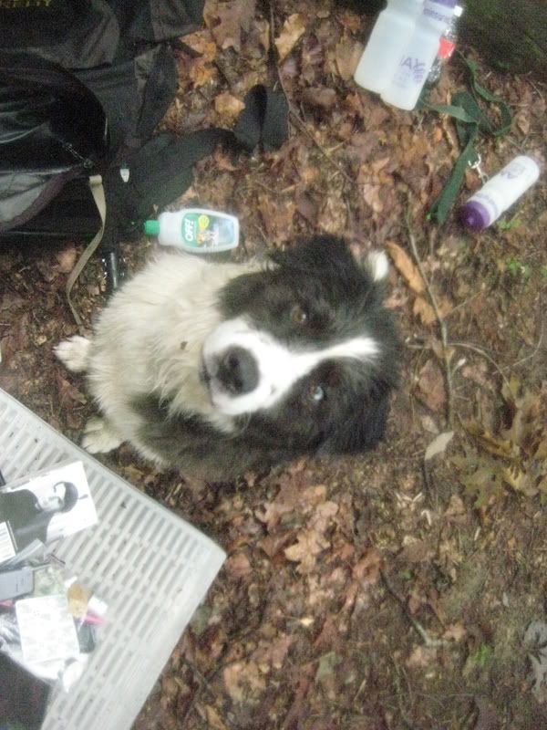
Once I had made it to camp, I was chaffed bad and wasted tired. I had planned for 10 miles and ended up logging 16 for the day. Buddy was a little tired after the effort and when I told him we were spending the night outside, this is what he had to say:
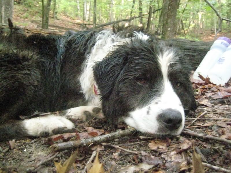
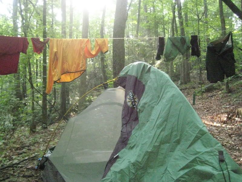
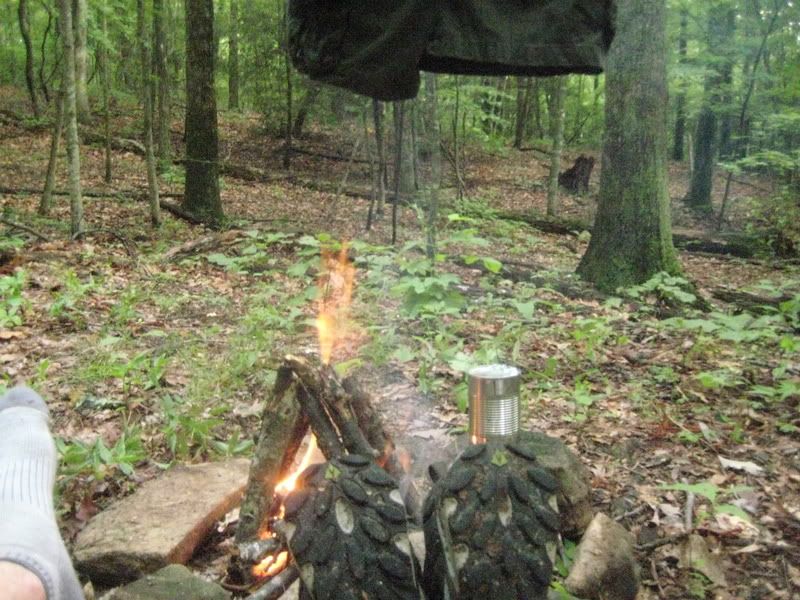
The evening went very well, I hung out in my underwear drying clothes and generally just hanging out. I hung a bear bag after our feast of dog food and Chef BoyRD meat filled ravioli’s even remembering to put my fork in the bear bag. The evening stayed balmy all throughout the night and since Buddy has frontline all over him, I picked ticks off of me all night as they would jump off of him onto me. Did I mention I only had two small tea candles and no flashlight?
Early morning came about and I was packed early but I had drank my 12th liter of water throughout the night which meant I only had one left to make it to some potable water source. **A quick note, Buddy was fine thoughout all of this water suffrage because the streams were a plenty and I would normally be willing to drink but I wasn’t about to catch a case of dysentery before heading to Vegas the next day. I did end up taking a few swigs from an upper mountain stream and I probably would have been fine with more but I wasn’t testing my luck**
So it was with these thoughts in my head that I decided to head further down Natural Land Trust, I wasn’t sure which way it took me but I figured it had to be better than the steep section that brought me to the campsite the night before.
As Buddy bounded happily down the trail, I had thoughts of cold water and soda. I came to the first intersection and immediately knew where I was. It was the intersection of Natural Land Trust and the Dismal Trail. From here I had another choice, hike up the Dismal trail which I know is extremely steep or head toward Raven’s cliff falls which is extremely steep. I figured that if I was going to suffer, I might as well have a waterfall to look at as I pass out. When I got to the cable crossing and the sign that informs hikers that they are .9 miles from the top of the falls, I knew exactly where I was again.
You see, a few years ago when my dad visited, we hiked this loop from the Raven’s Cliff parking area and as we headed up this section of trail, my Dad with no pack on his back said this to me half way up while standing on the steep trail “I think my little heart is going to pop out of my chest.”
What choice did I have? I started the slog as Buddy would bound up the slope and stop at an obstacle while he watched me suffer to keep up.
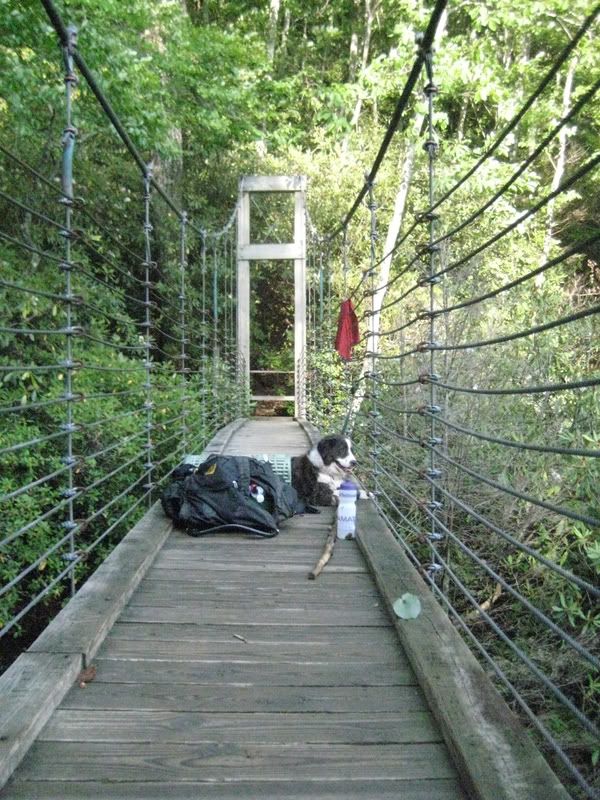
Eventually we made it to the bridge and I breakfasted with a handful of dry fruit while buddy laid there refusing to eat his own dog food.
I knew the worst part of the trail was behind me so I drank most of the water I had and left and filled with creek water for emergencies. I still had three and a half miles to the parking lot and another two up 276 to get to the visitor’s center.
Let me say that this 5 miles was hard, mind numbingly hard with no water. I was chaffed so bad from the day before that I had to walk like a defunct Rap Star with my hand on my crotch to alleviate the rubbing my shorts were causing. Later I realized that if I rolled my shorts up over the chaffing it alleviated it altogether even though I looked like I was wearing a cargo diaper.
Once I made it to the visitor’s center, every part of me wanted to con someone into giving me a ride down but I was so focused on cold drink I walked in and bought a 20oz Pepsi (they didn’t have coke), 20 oz Gatorade, filled my four bottles with water then went back outside to slurp in total ecstasy. After twenty minutes of drinking and watching distraught tourists look at me like I was the swamp thing, I decided I could push on. I took the two connector trails that ultimately led me to Jones Gap Trail and stumbled onward with my cargo diaper in full effect. As I hiked next to the Middle Saluda, all I could dream about was the hotel pool I would be visiting on the morrow.
I had planned for 15 miles over two days using 8 liters of water. I ended up with 26 miles circumnavigating both parks and drinking 17 liters of water plus the Pepsi and Gatorade. During the trip I ate one sandwich, two handfuls of dried fruit and a can of ravioli.
I had wanted to tear myself down before the Vegas trip and boy did I do a good job.